

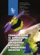
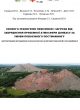

Authors: Oleksandr Trofymchuk, Vasyl Trysniuk, Taras Volynets, Viacheslav Vyshniakov
The monograph analyses the theoretical and applied foundations of integrating Earth remote sensing (ERS), geographic information systems, artificial intelligence and sensor networks to address environmental security and natural resource management. Particular attention is paid to algorithms for automated interpretation of satellite and aerial imagery, assessment of anthropogenic pressure, detection of crisis situations in the marine environment, and optimisation of large-scale ERS data processing. The book presents applied research on the state of the Black and Azov Seas and Ukraine’s coastal areas affected by military action and man-made disasters.
Intended for researchers, environmental and government professionals, students, PhD students and doctoral candidates.